Location and Geography
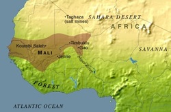
Map of the location of the Empire of Mali
Mali is located in Western Africa. In the times on the empire, it stretched south across the Sahel (which means "Shore") and the north into the Sahara (which means "desert" in the Arabic language)[i]. The empire was located on one of the world's most lucrative trade routes [ii] which was home to major trade cities such as Timbuktu and Gao. In the past, wealthy merchants lived in these cities, but once the Portuguese explorers started sailing the seas to trade, these landlocked cities fell[iii]. Salt and gold from the northern mines of the desert, and other goods such as nuts and grain from the southern part of the empire made this location ideal and wealthy [iv].
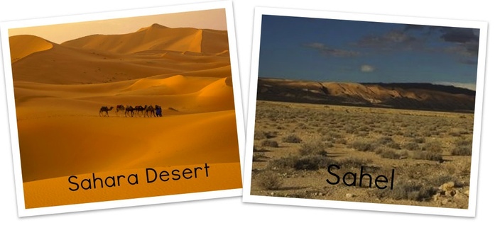
The Sahara desert is the largest desert in the world, known as the "Sea of Sand"[v]. It is located in the northern portion of Africa, and covers over 3,500,000 square miles (10% of the continent)[vi]. It has a very hot and dry climate, with virtually no water. The deserts northern boundary is the Mediterranean Sea, while its southern boundary is known as the Sahel. The Sahel is a semiarid region of north-central and western Africa, and forms a transitional zone between the Sahara to the north and the belt savannas to the south[vii]. It is the "shore" of the desert, a place were short grasses and shrubby buses grown at the deserts edge[viii]. The Niger River is the largest river in the area, and in the south, it provided water for farming, laundering and bathing. This river has an annual flood cycle, with high water between August and November[ix].This flooding make the plains of the Niger River agriculturally rich[x].
When the Empire of Mali reached its height in 1300 AD, it was one of the largest empires in the world, controlling the territory between the Atlantic Ocean and Lake Chad, a distance of nearly 1,800 miles[xi].